GEM-15 15m Elevation — Google
Quick answer: GEM-15 gives you 15 m DSM and bare-earth DTM heights for most land between 60°S and 84°N, free under CC BY 4.0 with the attribution “This dataset is produced by Google”. It is the sharpest openly licensed global DEM, but it excludes Russia, China, Mongolia, Greenland and Antarctica, and its heights are EGM96 orthometric metres.
Next step
Already have the export?
Open a GeoJSON result in the browser to inspect its map and attributes before sharing or converting it again.
Interactive preview
Click a 1° × 1° cell to get that cell's DSM and DTM GeoTIFF download links, or type a cell id such as w6s45. Only published cells are drawn, so gaps show where GEM-15 has no data.
Format
Cloud-Optimized GeoTIFF (COG)
Geometry
1° × 1° COG cells
Coverage
Near-global land from 60°S to 84°N across 13,485 cells; no Russia, China, Mongolia, Greenland or Antarctica
Resolution
15 m (DSM, DSM percentiles and DTM bands)
Vertical datum
EGM96 (EPSG:5773)
License
CC BY 4.0 — commercial use allowed with attribution
About this dataset
Google's 15-meter near-global elevation model, delivered as DSM and bare-earth DTM Cloud-Optimized GeoTIFFs on 1° × 1° cells.
GEM-15 is Google's near-global elevation model at 15-meter spacing, built from sub-meter optical stereo imagery acquired through 2024. Each 1° × 1° cell is a Cloud-Optimized GeoTIFF in its local UTM zone with a digital surface model, DSM percentiles and standard deviation, and a deep-learning bare-earth DTM. The public bucket holds 13,485 cells, so you can range-read a single pixel from the browser or download one cell for QGIS and GDAL instead of a continental mosaic.
Data source: GEM-15 on the Earth Engine publisher catalog
Attribution: GEM-15 © Google, licensed CC BY 4.0. Required attribution: “This dataset is produced by Google”. CC BY 4.0 — commercial use allowed with attribution
More detailed information: https://bertt.github.io/gem15/inspector.html — Community MapLibre viewer listing every 1° cell with its DSM and DTM download links.
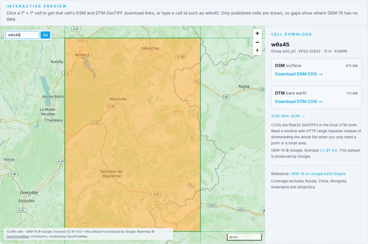
Actual coverage map screenshot: all 13,485 published GEM-15 cells, with cell w6s45 selected and its DSM/DTM download panel open. Map and basemap credits are shown in the image. Captured 15 November 2026.
How to download
- 1 Pick the 1° cell you need — cells are named by their south-west corner, so 45.8°N 6.9°E is w6s45 in group p40_p0.
- 2 Read the STAC item at gem-15/stac/gem-15/<group>/<cell>/<cell>.json to get the dsm and dtm asset URLs, UTM EPSG code and transform.
- 3 Stream a window with HTTP range requests, or download the whole COG (the DTM averages about 140 MB per cell; the DSM is several times larger).
- 4 Reproject from the local UTM zone when mosaicking, and expect NaN holes where water, snow, cloud shadow or low texture defeated stereo matching.
STAC catalog (no sign-up)
Root catalog; items live under gem-15/stac/gem-15/<group>/<cell>/<cell>.json
Public COG bucket
gs://climate-and-sustainability/gem-15 — DSM 9.38 TiB, DTM 1.81 TiB in total
Cell coverage index (GeoJSON)
13,485 existing 1° × 1° cells as polygons with cell id, group and UTM EPSG code
Earth Engine app (no download)
Browse DSM, DTM and height products without downloading
Evaluation code and preprint
doi:10.31223/X55N75
FAQ
Can I use GEM-15 commercially?
Yes. GEM-15 is licensed CC BY 4.0, which allows commercial and derivative use as long as you credit Google and link the licence. The publisher asks for the attribution “This dataset is produced by Google”, so keep it visible wherever the data or a derived map is shown.
Where is GEM-15 missing?
Coverage runs from 60°S to 84°N but excludes Russia, China, Mongolia, Greenland and Antarctica, and stops at coastlines. Water bodies, snow and ice, salt pans and other low-texture surfaces are masked as no-data, and India is shifted to comply with local geospatial regulations. Fall back to Copernicus GLO-30 or SRTM over those areas.
Is GEM-15 a DSM or a DTM?
Both are published. The DSM is the surface height including buildings and canopy, with 5th/50th/95th percentiles and a standard deviation of the native 0.5 m reconstruction; the DTM is a bare-earth prediction from a deep-learning model. Subtract DTM from DSM to get above-ground height.
Which vertical datum does GEM-15 use?
All bands are orthometric heights in metres on the EGM96 geoid (EPSG:5773), not WGS84 ellipsoidal heights — unlike Copernicus DEM, which uses EGM2008. Apply a geoid correction before mixing the two in a precise comparison.
How accurate is the 15 m elevation?
The GEM-15 preprint reports regional mean offsets of roughly −4.8 m to +1.9 m against airborne lidar, and DTM accuracy drops under dense forest where the ground is never visible from above. Treat it as a sharp regional model, not a survey.