Blank Map of Europe
Quick answer: A free outline map of Europe with 51 countries, drawn as clean polygons you can print and label. The interactive version below shows names on demand.
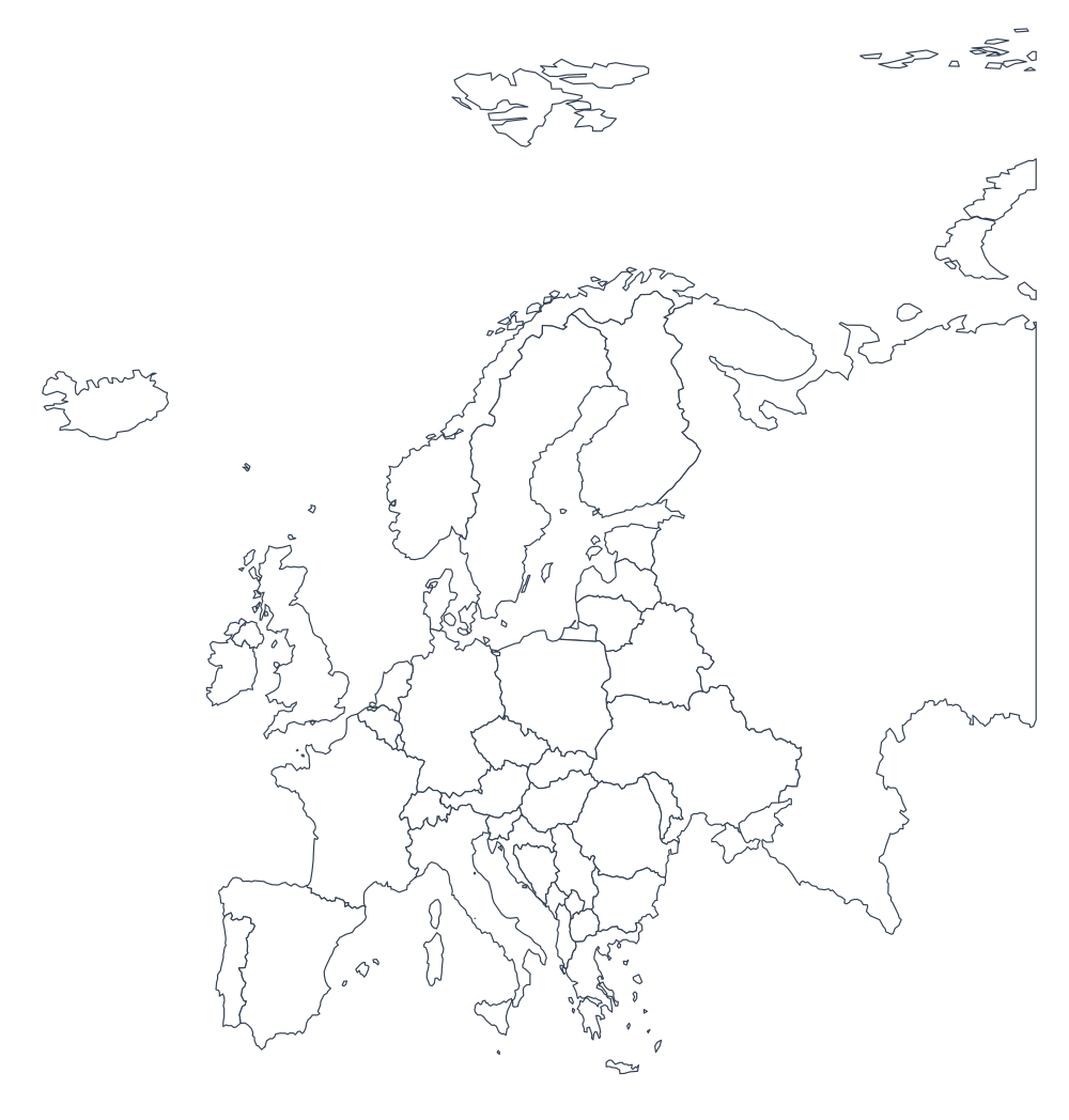
Map customization is loading. Download the blank SVG now.
Map customization is loading. Download the blank SVG now.
Download the default Europe outline (SVG) — available without JavaScript. Use the controls above for custom colors and text.
What this Europe map includes
The source contains 51 named countries and territories. Labels use the names in the Natural Earth dataset; simplified boundaries may omit tiny islands or fine coastal detail.
See the 51 names included in the source
- Åland
- Albania
- Andorra
- Austria
- Belarus
- Belgium
- Bosnia and Herzegovina
- Bulgaria
- Croatia
- Czech Republic
- Denmark
- Estonia
- Faroe Islands
- Finland
- France
- Germany
- Gibraltar
- Greece
- Guernsey
- Hungary
- Iceland
- Ireland
- Isle of Man
- Italy
- Jersey
- Kosovo
- Latvia
- Liechtenstein
- Lithuania
- Luxembourg
- Malta
- Moldova
- Monaco
- Montenegro
- Netherlands
- North Macedonia
- Norway
- Poland
- Portugal
- Romania
- Russia
- San Marino
- Serbia
- Slovakia
- Slovenia
- Spain
- Sweden
- Switzerland
- Ukraine
- United Kingdom
- Vatican City
Choose a printable map format
| Format | Best use | What is preserved |
|---|---|---|
| SVG | Editable artwork, classroom worksheets, large prints | Vector boundaries, colors and text |
| PNG | Slides, documents and images | Current design at 1,200–7,200 px wide |
| Letter, A4, Tabloid, A3, A2 or A1 paper | High-resolution image fitted to the chosen page | |
| GeoJSON | GIS analysis and conversion | Original coordinates and properties; no inset positioning |
About this blank map
This is an outline map of Europe with no labels, no cities, and no colour fills beyond white — the version you want when the point is what you write on it. Every division is a separate polygon, so you can print it and fill in names, mark places, or plan a route without the map arguing with your annotations.
Customize the land, borders, background, and text colors above. Add a title, choose a font, or turn on Show names for a reference version. Crowded labels are hidden to keep the map readable. The preview and your SVG, PNG, or PDF download use the same settings.
What is on the map
- Units drawn
- 51 countries
- Extent
- 72.00°N to 34.00°N, 25.00°W to 60.00°E
- Projection
- Latitude-adjusted equirectangular
- Data licence
- Public domain (CC0)
Country outlines from the Atlantic to the Urals.
How to use it
- Print the outline. Use your PDF download for a print-ready page, or download SVG for a scalable vector map. A heavier line weight helps on a large sheet.
- Label it. Fill in the names yourself — that is the exercise a blank map exists for. Turn on Show names when you want to check your work.
- Reuse the data. The Download GeoJSON button gives you the same boundaries as a file, ready to load into the Studio viewer, convert to Shapefile or KML, or use in your own map.
Where the data comes from
The boundaries are Natural Earth’s 1:10m administrative layers, simplified to 5% of their original detail with mapshaper. Natural Earth is a public-domain dataset maintained by cartographers, and it is the standard choice for exactly this kind of work because there is no attribution requirement and no restriction on commercial use.
Simplification is deliberate. The full-detail files carry hundreds of thousands of vertices per region, which makes pages slow and outlines fussy to annotate. Simplifying to 5% keeps every unit and the recognisable shape while cutting the file size by about 93%.
A limitation worth stating: simplified boundaries are not survey-accurate, and Natural Earth itself resolves some disputed borders in a particular way. Treat this map as a teaching and planning aid, not as an authority on where a border legally runs.
Related blank maps
- Blank world map 258 countries
- Blank map of Asia 59 countries
- Blank map of Africa 55 countries
- Blank map of North America 42 countries
- All 110 blank maps World, continents, US states, and countries
Related tools
- Studio viewer Open this GeoJSON and style it yourself.
- Create a map Turn your own data into a map.
- World flags map The same outlines, filled with national flags.
- GeoJSON to Shapefile Convert the download for desktop GIS.
Frequently asked questions
- Is this blank map of Europe really free?
- Yes. There is no account, no payment, no watermark, and no limit on how many times you print or download it. The data behind it is public domain, so there is nothing to license.
- Can I print this map?
- Yes. Download a PDF fitted to your chosen paper size, a high-resolution PNG, or an SVG for scalable vector artwork. Customize the border width, colors, and text before downloading.
- Can I use this map commercially?
- Yes. The boundaries come from Natural Earth, which is released into the public domain with no attribution required and no restriction on commercial use. You can put the map in a product, a paid course, a book, or an advertisement.
- Can I label the map myself?
- That is the point of a blank map. Print it and write on it, or turn on Show names above to see what the divisions are called, which is useful when you are preparing an answer key. The names come from the data itself.
- What do the divisions on the map represent?
- Each polygon is one administrative division of Europe. This file contains 51 of them. Administrative divisions are the level below national government — states, provinces, regions, or districts depending on the country.
- How accurate are the boundaries?
- They are simplified from Natural Earth's 1:10m dataset. The simplification keeps every unit and the overall shape, but drops coastline detail that a blank map does not need. For a legal or survey boundary, use the authoritative source for that country instead.
- Why is the map so simple compared with other outline maps?
- Because detail works against the purpose. A blank map is meant to be printed, labelled, and drawn on, and a coastline traced with thousands of tiny vertices is harder to read and much slower to load than a clean outline. The full-detail version is available from Natural Earth if you need it.
- Can I download the data behind this map?
- Yes. The Download GeoJSON button above gives you the exact file the map is drawn from, with each unit carrying its name. You can load it in the Studio viewer, convert it to Shapefile or KML, or use it in your own project.
- Does the map work on a phone?
- Yes. The preview fits the screen, with color and text controls below it on smaller screens. Use the zoom controls and drag to inspect details. Fit map restores the full view; downloads always include the entire map.
- Can I use this map in a slide deck or video?
- Yes. Take a screenshot of the map area, or download the GeoJSON and style it to match your deck. Public domain means there is nothing to clear first.
- Which projection is the map drawn in?
- The outline uses an equirectangular projection adjusted for the centre latitude of each map. Distant territories may appear in separate insets at different scales. It is intended for reference and worksheets, not distance or area measurement.
- Are there maps of other places?
- Yes. There are 110 blank maps in this set: the world, six continents, every US state plus the District of Columbia, and 52 countries. They are linked at the bottom of this page.