World Flags Map & Download — Every Country Flag on Its Own Territory
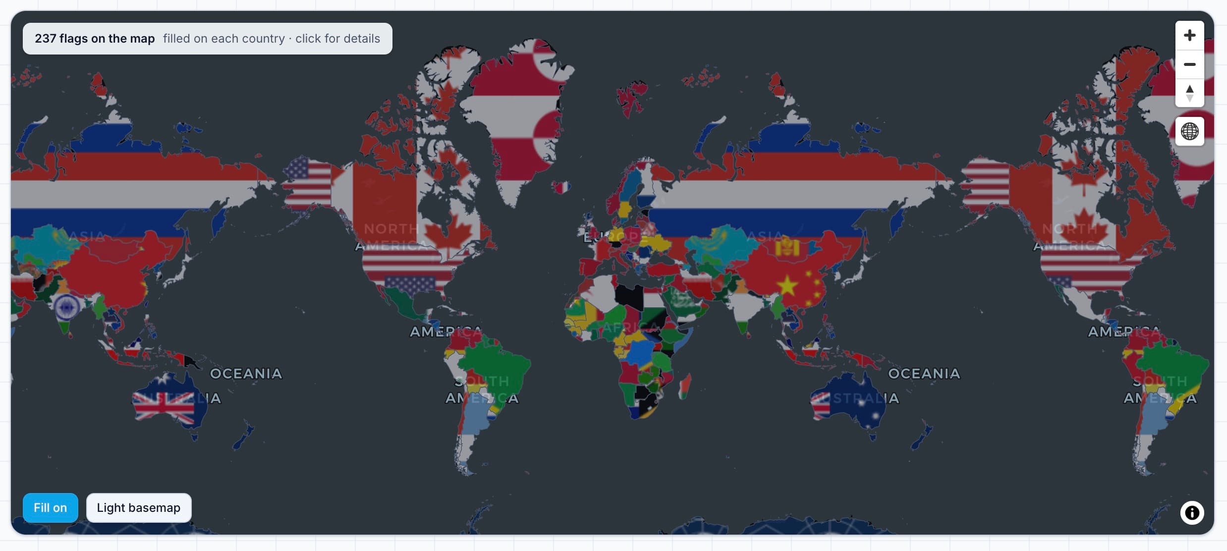
Quick answer: every country's flag is drawn on its own territory, on a 3D globe or a flat map. Search or filter the list by continent and country code, and download all 255 flags as PNG or SVG.
All country flags
0 of 0 flags
No countries match “”.
Download the flag set
All 255 flags, packaged as a zip and named by ISO 3166-1 alpha-2 code — so us.png is the United States and de.png is Germany. The three packs contain identical coverage at different sizes; pick the one that matches your use.
- PNG 200 pxPNG · 200 px
UI cards, list rows, and small markers
The same size this page renders with.
Download 569 KB - PNG 1000 pxPNG · 1000 px
Print, large tiles, and high-DPI screens
Download 2.76 MB - SVG (vector)SVG · vector
Any size without quality loss; editing and styling
Resolution independent, and usually smaller than the PNGs.
Download 1.27 MB
Each archive contains 255 image files and nothing else — no index or manifest. The mapping from code to country name is on this page, in the list below.
National flags are generally in the public domain, so the artwork can be reused. That does not override a country’s own rules on how its flag may be displayed or used commercially.
What this page shows
237 flags placed on the countries they belong to, plus the complete list below. Each entry carries the country name, its ISO 3166-1 alpha-2 code, its continent, and an estimated population.
How to use it
Pan and zoom the map to explore, or use the search box to find a country directly. Clicking a flag on the map or a card in the list flies the map to that country and opens its details.
Filter by continent
The continent buttons narrow the list to Africa, Asia, Europe, the Americas, or Oceania — useful when you want to compare flags within one region rather than scrolling through the whole world.
Reading a flag
Most national flags use a small set of recurring devices: horizontal or vertical bands, a canton in the upper hoist, and a central emblem. Grouping by region makes those family resemblances — the Nordic cross, the Pan-Arab colours, the Union Jack canton — easy to spot.
Country codes
The two-letter code under each name is the ISO 3166-1 alpha-2 code, the same identifier used in country datasets, top-level domains, and most GIS joins. Kosovo is the notable exception, using the user-assigned code XK.
Using this with data
The codes make the page a practical lookup when joining a dataset: match on alpha-2, or convert to alpha-3 for sources such as Natural Earth. Both are available from the boundary data directory.
Using the flag set in your own project
The files are named by ISO 3166-1 alpha-2 code, which is the same
identifier most country datasets use. That makes them drop-in
replacements in a data-driven interface: join on the code you already
hold, and the matching artwork is there. A handful of entries are not
ISO codes — Kosovo uses the widely adopted xk, and the UK constituent countries use six-letter codes such as
gb-sct.
Sizing decisions are usually simpler than they look. Vector SVG covers every case where the format is supported, so it is the safest single choice. Raster only becomes necessary for print pipelines or tooling that cannot read SVG, and then 1000 px is enough for anything up to full-page width at print resolution. The 200 px set exists for the opposite reason: interface rows and marker icons, where shipping larger files costs bandwidth for no visible gain.
One practical caution: flags have inconsistent aspect ratios. Nepal is taller than it is wide, Switzerland and Vatican City are square, and most others sit between 3:2 and 2:1. Stretching them all into one box distorts the national flag, so preserve the ratio and letterbox instead.
Frequently asked questions
- How many country flags are shown on this map?
- 237 flags, covering every sovereign state plus dependent territories that have their own flag, such as Greenland, Puerto Rico, and Hong Kong. Each flag is drawn on the country it belongs to.
- Where does the flag artwork come from?
- The flags are accurate SVG and PNG renders from the open country-flags dataset, which draws its source files from Wikimedia Commons. National flags are generally in the public domain, though some countries restrict how their flag may be used.
- Why do some territories share a flag with their parent country?
- Some dependencies do not have a separate flag, so they either use the parent country's flag or are grouped under it. The map shows the flag the territory actually flies, which is why you may see the same design in more than one place.
- What do the two-letter codes next to each flag mean?
- They are ISO 3166-1 alpha-2 country codes — the standard two-letter abbreviations such as US, DE, or JP. Kosovo uses XK, which is not officially assigned by ISO but is widely used in practice.
- Can I use these flags in my own project?
- National flags are generally not subject to copyright, so the artwork can be reused. That does not grant permission to use a flag in ways a country restricts — for example some nations regulate commercial or disrespectful use of their flag.
- How are the flags positioned on the map?
- Each flag is placed near the centre of the country's largest landmass, and the flag artwork is also tiled across the territory itself. For countries spread across many islands or with overseas territories, that keeps the marker on the main territory rather than dropping it into the ocean.
- Can I download the flag images?
- Yes. All 255 flags are available as three zip archives: PNG at 200 pixels, PNG at 1000 pixels, and SVG vector. The files are named by ISO 3166-1 alpha-2 code, so us.png is the United States and de.png is Germany. No account or attribution is required.
- Which flag pack should I download, PNG or SVG?
- Choose SVG if you can use vector files: it is resolution independent, so one download covers every size, and the archive is smaller than the 1000 pixel PNGs. Choose PNG 200 px for user interface work such as list rows and small markers, where its smaller size is an advantage. Choose PNG 1000 px for print or very large displays where a raster is required.
- Are the flags free to use in commercial projects?
- National flags are generally not protected by copyright, so the artwork itself can be reused commercially without attribution. That is separate from a country's own rules about how its flag may be displayed, which can restrict certain uses regardless of copyright.
- Why is a country missing from the download?
- The set covers 255 flags: every sovereign state plus dependent territories and the UK constituent countries, which have their own codes such as gb-sct. A small number of disputed areas have no ISO code and therefore no flag in this dataset; those are also absent from the map and the list above.
Related tools and data
- Country boundaries — download the polygons these flags sit on.
- Boundary data directory — Natural Earth, GADM, and other sources.
- Population datasets — the demographic data behind the figures shown here.
- Studio viewer — open a boundary file and join your own attributes.