OurAirports CSV Download — Airports & Runways
Quick answer: Download airports.csv and runways.csv from OurAirports, or start from the hosted 10,887-airport GeoJSON on this page — it carries IATA/ICAO codes, type, country and elevation, renders by airport type, and summarises by type and country.
Turn airport records into a map layer
- 1.Download airports.csv from the source options below. Runway records are a separate table; choose the airport file for point locations.
- 2.Open the CSV and inspect the longitude_deg and latitude_deg fields. Check airport identifiers and types before selecting records for your project.
- 3.Keep the source date with your export. Use the original airport identifiers when joining runways or other tables; a name alone may be ambiguous.
About this dataset
Global airport and runway tables from OurAirports, plus a hosted 10,887-airport GeoJSON you can map and summarise instantly, rendered by airport type.
Download free airport GIS source tables from OurAirports — airports.csv and runways.csv — and convert them into GIS layers for mapping and transport analysis. This page hosts the mappable airport subset: 10,887 airports with an IATA code or a large/medium/seaplane-base classification, carrying name, ident, ICAO, type, country, municipality and elevation, so the preview and the country/type summary load without any CSV wrangling. On the map each airport type gets its own colour and marker size. Unregistered private fields and hospital helipads are intentionally excluded, and runway rows stay in the upstream runways.csv.
More detailed information: https://ourairport.app/ — Browse 80,000+ airports with codes, maps and guides; open each airport page for detailed information.
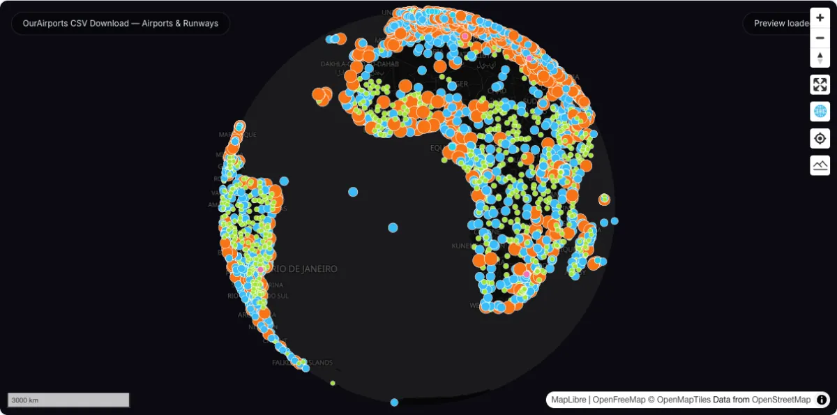
Actual dataset map screenshot; map and basemap credits are shown in the image. Captured 30 September 2026.
How to download
- 1 Explore the hosted layer above — the summary breaks airports down by type and country.
- 2 Download the hosted GeoJSON for web maps or dashboards.
- 3 Need every row, including private fields and helipads? Grab airports.csv and filter to your region.
- 4 Filter by type or country in GIS to build regional aviation layers.
FAQ
Is OurAirports already a GIS file?
The upstream data is CSV. This page hosts a ready GeoJSON so you can map it immediately, and the original CSV stays one click away for full-table work.
How are airports rendered on the map?
Each airport type gets its own colour and marker size: large airports orange and largest, medium airports blue, small airports green, seaplane bases cyan, heliports pink. Airports without a recognised type fall back to grey.
Why does the hosted file have fewer airports than airports.csv?
The CSV carries 70,000+ records including private fields and hospital helipads. The hosted layer keeps the 10,887 airports that have an IATA code or a large/medium/seaplane-base classification — the ones people actually map.
What fields does each airport carry?
Name, ident, IATA, ICAO, type, ISO country, municipality, elevation in feet, and a scheduled-service flag.