US Private Schools — 31,000+ Locations
Quick answer: Download 31,000+ geocoded US private school locations as a CSV with NCES IDs, addresses, enrollment, grade spans, and teacher counts, and view them on an interactive map.
About this dataset
More than 31,000 private schools across all 50 US states plus DC, with names, addresses, enrollment, and grade ranges.
This dataset maps over 31,000 private schools in the United States, from small elementary academies to large independent high schools. Each point includes the school name, NCES ID, full mailing address, county, enrollment, grade span, full-time teacher count, and website where available. The data originates from the NCES Private School Universe Survey, geocoded to latitude/longitude, and is ideal for education-access studies, market analysis, and demographic overlays.
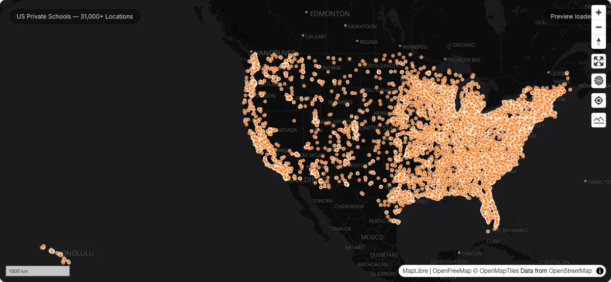
Actual dataset map screenshot; map and basemap credits are shown in the image. Captured 30 September 2026.
How to download
- 1 Download the Private_Schools.csv file.
- 2 Open the map preview on this page or load the CSV in GeoDataViewer Studio.
- 3 Filter by state, county, grade span, or enrollment in the attribute table.
- 4 Combine with public school and population layers for coverage analysis.
FAQ
What attributes does each school record have?
Each row includes the school name, NCES ID, street address, city, state, ZIP, county, enrollment, grade span (start and end grade), full-time teacher count, NAICS classification, website, and geocoded latitude/longitude.
Where does the data come from?
The underlying records come from the US Department of Education's NCES Private School Universe Survey, with each school geocoded to coordinates. It is US government data in the public domain.
How accurate are the school coordinates?
Coordinates were validated against imagery and other sources during the original geocoding process, so most schools land on their correct parcel. Treat remote or rural placements with normal geocoding caution.
Can I convert the CSV to GeoJSON?
Yes — GeoDataViewer reads the latitude/longitude columns automatically. Drop the CSV into Studio and export it as GeoJSON, or use the file converter for a standalone conversion.