Most Photographed Places — Global Geotagged Photo Locations (2026)
Quick answer: The Most Photographed Places dataset maps 418,880 geotagged Flickr photos worldwide, revealing global photography density, travel hotspots, and cultural landmarks in a pre-tiled PMTiles format.
About this dataset
Global dataset of 418,880 geotagged Flickr photos from 2026, visualizing worldwide photography density and travel hotspots in PMTiles format.
The Most Photographed Places dataset contains 418,880 geotagged photo records from Flickr in 2026, curated from Kobakhit Photo Geography. Structured as a high-performance PMTiles raster density archive (z1–z6 with 2x enhanced 512px detail), it maps photography density, urban hotspots, and iconic landmarks across every continent. Best viewed on a dark basemap to highlight vibrant density clusters.
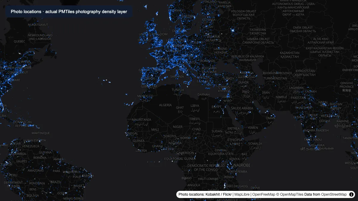
Actual photography-density raster tiles read from the hosted PMTiles archive and rendered over OpenFreeMap. Data: Kobakhit / Flickr; basemap credits are shown in the image.
How to download
- 1 Download the photos-z1-6-2x-enhanced.pmtiles file or load it directly via URL.
- 2 Open the dataset in GeoDataViewer Studio or inspect the interactive map preview below.
- 3 Use the OpenFreeMap Dark basemap to clearly distinguish high-density photo clusters.
- 4 Zoom into cities, coastlines, and national parks to analyze regional photography hotspots.
FAQ
What does the photos-z1-6-2x-enhanced PMTiles file contain?
It contains 418,880 geotagged photo records from Flickr in 2026, structured as raster density tiles covering zoom levels 1 to 6 at 2x 512px resolution to visualize global photography hotspots.
Why does this dataset use the OpenFreeMap Dark basemap by default?
A dark basemap provides the highest visual contrast for bright, glowing point clusters, making dense photography hotspots in cities and scenic landmarks stand out vividly.
How can I open this PMTiles dataset in GIS software?
You can inspect it directly in GeoDataViewer Studio or load the pmtiles:// URL in MapLibre GL JS, QGIS (with PMTiles plugin), or Protomaps viewers.